Google has recently started testing its AR navigation feature for Google Maps. The feature is currently being tested and is only available to some of users. Now this new AR navigation feature was revealed by Google at last year’s I/O developer’s conference. The new augmented reality feature for Google Maps, which would provide people with directions from your phone’s camera in realtime.
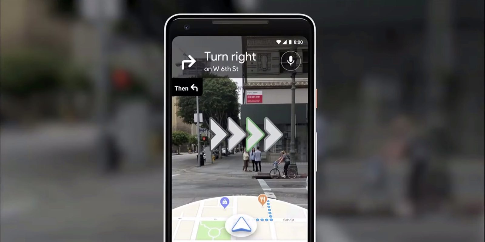
The Wall Street Journal’s David Pierce got to try out an early version of the feature. He says that while it isn’t likely to be your primary turn-by-turn option, it’s a huge step in the right direction for Google Maps. He also described how the feature worked and how the the app picks up a person’s location via GPS, and then uses Street View data to narrow it down to your exact location. Once his location was pinned down, it displayed big arrows and directions in his screen. It was as if Maps had drawn my directions onto the real world, though nobody else could see them.
Google has reportedly been experimenting with the user interface, finding that users will follow a line on the ground too closely, and that an animated guide will keep them glued to the screen.
Pierce said that the interface he previewed could change, and that Google isn’t saying when the feature will roll out to users, just that it’ll be available to a few Local Guides soon, and will come to everyone only when Google is satisfied that it’s ready.
Pierce also said that there many features that is good to use. The first and one of the best one is that it provide people with very specific location data, and that it’s a feature that isn’t likely to remain on phones, but on AR-capable glasses.